


SityTrail GPS de randonnée
Description de SityTrail GPS de randonnée
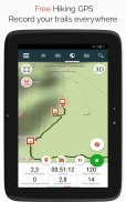
SityTrail est un GPS de randonnée gratuit pour toutes vos randos dans le monde !
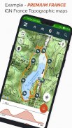
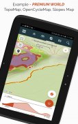
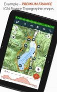
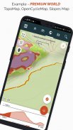
Premium: Communauté SityTrail, IGN France, Belgique, Espagne, Canada, USA, OpenTopoMap.
Partez gratuitement à la découverte de tous les sentiers du monde !
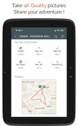
• Enregistrez vos randonnées et prenez des photos géolocalisées de vos aventures.
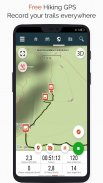
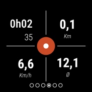
• Distance parcourue, Km-effort, vitesse moyenne, allure, calories brûlées.
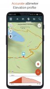
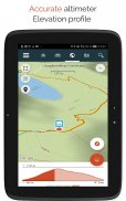
• Altimètre précis, calcul de dénivelés et profil altimétrique avec votre position.
• Alarme en cas d’éloignement de l’itinéraire suivi. Evitez de vous perdre ou de devoir rebrousser chemin.
• Déclenchement automatique des points d’intérêt et lecture des textes avec synthèse vocale.
• Créez un compte serveur et vos données seront accessibles partout.
• Création simple de circuits de randonnée et de points d'intérêt depuis notre site Web.
• Avec notre éditeur en ligne, créez vos projets de randonnée depuis un navigateur Internet sur PC/Mac et retrouvez les directement sur votre iPhone pour les vivre sur le terrain.
• Classez et organisez vos données dans des listes personnelles.
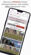
Passez ensuite à SityTrail PREMIUM !
• Téléchargez des cartes topographiques du monde en mode hors ligne.
• Découvrez tous les réseaux pédestres comme les GR, PR, les itinéraires européens, les chemins de Saint-Jacques de Compostelle pour les pélerins.
• Ajoutez les cartes topographiques de votre choix : IGN France, IGN Belgique, IGN Espagne, swisstopo, Autriche, Etats-Unis - USGS, Canada - Toporama.
• Découvrez également tous les réseaux vélo avec les Voies vertes en France, Ravel en Belgique, itinéraires européens, les réseaux Points-Nœuds au Pays-Bas et en Flandre.
• Et pour l'hiver, découvrez toutes les pistes de Ski par couleur avec leur nom.
• Accédez au catalogue public des randonnées des membres et communautés de SityTrail.
• Fonctions avancées de suivi d'une randonnée avec estimation de la distance et du temps restants et guidage vocal aux changements de direction.
• Allez plus loin : transformez vos randonnées coups de cœur en véritables guides multimédia avec textes, photos, liens vers des vidéos et partagez-les avec la communauté SityTrail.
• Créez des communautés de randonneurs et gérez vos membres et vos flux d'actualités.
• Création de randonnées avec fonctions avancées d'édition depuis notre site Web.
• Impression PDF au format A4 et A3 des cartes de randonnée avec QR Code.
• Consultez les articles Wikipédia géolocalisés depuis notre module SityTrip.
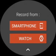
Enregistrez des randonnées sur votre montre Wear OS
Vous pouvez enregistrer une randonnée sur votre montre Wear OS en mode autonome (lorsque la montre n'est pas connectée à un smartphone Android) ou en mode appairé (lorsque la montre est connectée à un smartphone Android).
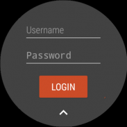
L'application permet également de se connecter à son compte SityTrail existant (depuis l'écran le plus à gauche) lorsque la montre est en mode autonome.
Informations importantes
• Certaines fonctionnalités nécessitent une connexion à Internet.
• L’utilisation prolongée du GPS peut diminuer le niveau de batterie.
SityTrail GPS de randonnée - Version 12.15.1.55
(17-02-2025)SityTrail GPS de randonnée - Information APK
Version APK: 12.15.1.55Package: com.geolivesAncienne Version de SityTrail GPS de randonnée
Autres versions


Applications de même catégorie

Vous pourriez également aimer...


